by Michael Frye | Mar 17, 2019 | Travels and Stories
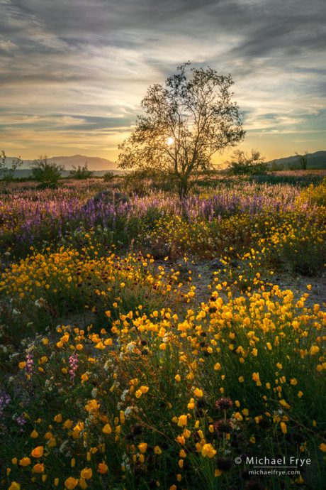
Desert in bloom at sunset, Joshua Tree NP, California. I bracketed three exposures, two stops apart, and blended them with Lightroom’s HDR Merge. 33mm, f/16, ISO 100.
Last week Claudia and I visited family in Southern California, and, while we were in the neighborhood, detoured to some early-season wildflower spots: Walker Canyon, Anza-Borrego Desert State Park, and Joshua Tree National Park.
In past years I’ve photographed beautiful wildflower displays in semi-desert areas like Antelope Valley and the Carrizo Plain, but never in true, low-desert habitats like Anza-Borrego and Joshua Tree. It was amazing to see these normally-dry places blooming. The hills in Anza-Borrego were so green that in the right light, if you squinted (and used your imagination), it looked a bit like Ireland. The birds were in a springtime mood as well; we walked up a wash one afternoon accompanied by a symphony of bird song.
(more…)
by Michael Frye | Mar 10, 2019 | Light and Weather
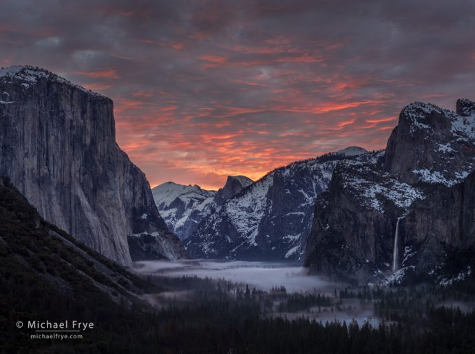
Sunrise from Tunnel View, Yosemite. On this morning the satellite images showed lots of high clouds, but I hoped there might be a gap to the east, allowing the sun to shine through and light the underside of the clouds. And I hoped for mist on the valley floor. That was asking for a lot, but sometimes things work out. The color lasted about three minutes. 50mm, three bracketed exposures, two stops apart, blended with Lightroom’s HDR Merge.
While early February brought lots of snow to Yosemite Valley, over the last three weeks we’ve seen a series of warmer storms, with rain rather than snow. I’d rather have snow, of course, but any weather is more interesting than blue skies. And rain on top of snow is a great mist producer.
Fog or clouds form when the temperature and dew point converge. That means either cooling the air to meet the dew point (like when air rises, and cools, and the water vapor in the air condenses into clouds), or raising the dew point to meet the air temperature (by increasing the amount of moisture in the air).
(more…)
by Michael Frye | Feb 20, 2019 | Light and Weather
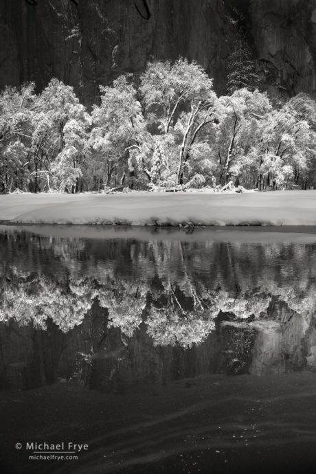
Snow-covered oaks reflected in the Merced River, Yosemite NP, CA, USA
On that snowy day I wrote about in my previous post the sun came out quickly, so our first stop was a spot near El Capitan that was still in the shade. I was looking for reflections, but then the sun hit the oaks across the river, while a cloud threw shade over El Cap, creating a beautiful contrast between the bright white trees and the dark cliff behind them.
The snowbank below the oaks, however, was really bright and distracting. All I need, I thought, is for a cloud to shade that snowbank while the sun was still hitting the trees. And a minute later it happened, setting up a dark-light-dark-light pattern. (That’s the image at the top of this post.)
(more…)
by Michael Frye | Feb 13, 2019 | Light and Weather
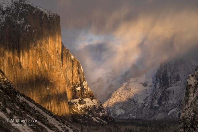
Stormy skies over the valley, Yosemite, Sunday evening
We’ve had one storm after another here in the Sierra Nevada. Two more storms came through this past weekend, back to back. They were cold systems, so it snowed in Yosemite Valley, with about five inches on Friday night, and another eight or nine inches on Saturday night and Sunday morning – all on top of at least 18 inches left over from the previous series of storms. The valley was quite a snowy place.
I kept checking the weather last weekend to see whether there might be a break between the first and second storms. All signs pointed to a partial break late on Saturday morning, but there seemed to be a slight chance that the storm might clear closer to sunrise on Saturday, so I drove up early – only to wait as a shower rolled in and dumped heavy snow for an hour.
(more…)
by Michael Frye | Feb 7, 2019 | Light and Weather
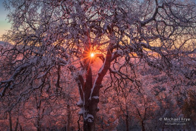
Ice-coated oaks at sunset, Mariposa County, CA, USA
California got hit by a big storm. It was actually a series of storms that started last Friday and ended late Tuesday, but it felt like one long storm because there was little break between the systems. We didn’t see the sun in Mariposa from Friday until Tuesday.
Yosemite Valley received 8 1/2 inches of precipitation (rain and snow equivalent) since Friday. That’s the largest amount I remember seeing over such a short period. (There was probably more rain during the ’97 flood, but I didn’t pay attention to the rain totals then).
(more…)


